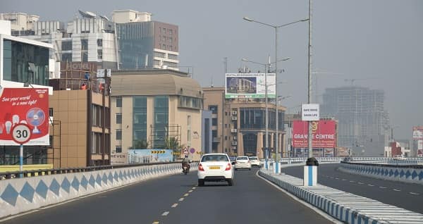
The Maa Flyover is one of Kolkata’s most celebrated and transformative pieces of urban road infrastructure, fundamentally reshaping how the city’s residents and commuters navigate the eastern and central parts of West Bengal’s capital. Stretching impressively from Parama Island near Park Circus to the Eastern Metropolitan Bypass (EM Bypass) and further connecting toward Ultadanga, the Maa Flyover is among the longest urban flyovers in India and stands as a landmark achievement in Kolkata’s modern infrastructure story. Its construction dramatically reduced travel times across one of the city’s most congested zones, offering commuters a seamless elevated passage that bypasses the notorious ground-level traffic of Central and South Kolkata.
The name “Maa” — meaning mother in Bengali — resonates deeply with Kolkata’s cultural and emotional identity, and the flyover has been embraced by the city’s residents as both a practical mobility solution and a point of civic pride. The flyover connects some of Kolkata’s most important neighborhoods, commercial districts, and transit hubs, making it an essential artery for daily commuters, business travelers, logistics operators, and airport-bound passengers. Whether you are a long-time Kolkata resident, a professional relocating to the city, a real estate investor evaluating opportunities in the eastern corridor, or simply a visitor trying to understand how to get around efficiently, a thorough understanding of the Maa Flyover — its directions, connectivity, and surrounding areas — is invaluable for navigating this magnificent and complex metropolis.
Maa Flyover Overview
| Detail | Information |
| Location | Parama Island to Ultadanga, Kolkata, West Bengal |
| Primary Roads | EM Bypass, AJC Bose Road, VIP Road |
| Nearest Metro Station | Park Circus / Sealdah — Kolkata Metro Lines |
| Key Roads Connected | EM Bypass, AJC Bose Road, VIP Road, Ultadanga Road |
| Total Flyover Length | Approx. 5–6 km (one of Kolkata’s longest) |
| Distance from City Centre | Approx. 4–6 km from Esplanade |
| Distance from Airport | Approx. 12–15 km from Netaji Subhas Chandra Bose International Airport |
| Governing Authority | KMDA, NHAI, PWD West Bengal |
| Nearby Landmarks | Science City, Nicco Park, City Centre 1 & 2 |
| Structure Type | Elevated Road Expressway / Multi-Lane Flyover |
| Public Transport Options | Kolkata Metro, WBTC Bus, App Cabs, Yellow Taxis |
| Best Suited For | East Kolkata to Central Kolkata corridor traffic |
| Peak Traffic Hours | 8:30 AM – 10:30 AM and 5:00 PM – 9:00 PM |
Directions to Maa Flyover
From Esplanade / City Centre: Travel eastward from Esplanade along AJC Bose Road heading toward Park Circus. After crossing Park Circus junction, the Maa Flyover access ramp is available from Parama Island. Total distance from Esplanade is approximately 4 to 6 kilometres with a travel time of 20 to 35 minutes.
From Netaji Subhas Chandra Bose International Airport: Exit the airport and take VIP Road heading southward toward Ultadanga. The northern end of the Maa Flyover is accessible from Ultadanga junction. The total distance from the airport is approximately 12 to 15 kilometres with a travel time of 25 to 45 minutes.
From Howrah Station: Cross the Howrah Bridge or Second Hooghly Bridge and head eastward through Central Kolkata via AJC Bose Road. Continue toward Park Circus and access the Maa Flyover from the Parama Island entry ramp. Travel time is approximately 30 to 50 minutes.
From Salt Lake City / Sector V: Take EM Bypass heading southward from Salt Lake. Continue along the bypass toward Parama Island where the Maa Flyover originates. The distance from Salt Lake Sector V is approximately 8 to 10 kilometres.
From New Town / Rajarhat: Take New Town Connector or Action Area roads heading toward EM Bypass. Merge onto EM Bypass heading south toward Ultadanga and access the Maa Flyover from its northern approach. Travel time from New Town is approximately 30 to 45 minutes.
Metro and Public Transport Connectivity
The Maa Flyover corridor is served by multiple Kolkata Metro lines that provide comprehensive rail-based public transport coverage across its length. Park Circus Metro Station and Sealdah Metro Station on the East-West Metro Corridor offer direct access to the southern end of the flyover near Parama Island. The Ultadanga end is served by stations on the North-South Metro Line extension, connecting commuters to Noapara, Dakshineswar, and all stations in between.
West Bengal Transport Corporation (WBTC) operates several high-frequency bus routes along AJC Bose Road, VIP Road, and EM Bypass, serving the full length of the Maa Flyover corridor. Yellow taxis — Kolkata’s iconic public transport — and app-based cabs operate extensively throughout this zone. The combination of metro access and surface bus services makes the Maa Flyover corridor one of the best-served public transport zones in the city.
Road Connectivity
The Maa Flyover connects several of Kolkata’s most critical road arteries:
- EM Bypass runs north to south through East Kolkata, connecting Salt Lake, New Town, and Rajarhat to the southern suburbs.
- AJC Bose Road connects the flyover’s southern end to the heart of Central Kolkata.
- VIP Road extends northward toward the airport, making the flyover a key segment of the airport access route.
- Ultadanga Road provides connectivity to the northern residential and commercial zones of the city.
Nearby Areas and Neighbourhoods
Science City: One of India’s largest science museums and recreational science complexes, Science City is located immediately adjacent to the Maa Flyover along EM Bypass and is a major landmark and leisure destination for Kolkata residents.
Nicco Park: A popular amusement and recreation park located near the EM Bypass corridor, Nicco Park is accessible from the flyover and is a prominent family entertainment destination in East Kolkata.
City Centre 1 and City Centre 2: Two of Kolkata’s premier commercial and retail complexes, City Centre 1 in Salt Lake and City Centre 2 in New Town are both within comfortable reach of the Maa Flyover via EM Bypass.
Park Circus: A densely populated and culturally diverse neighbourhood at the southern end of the flyover, Park Circus is known for its vibrant residential character, local markets, educational institutions, and excellent connectivity.
Ultadanga: A rapidly developing residential and commercial locality at the northern end of the flyover, Ultadanga is growing in appeal among young professionals and families seeking well-connected housing within Kolkata’s city limits.
New Town and Rajarhat: Kolkata’s most ambitious planned urban development, New Town hosts IT companies, government offices, premium residential townships, and the DLF IT Park — all connected to the Maa Flyover via EM Bypass.
Frequently Asked Questions (FAQs)
Q1. How long is the Maa Flyover in Kolkata?
A: The Maa Flyover stretches approximately 5 to 6 kilometres, making it one of the longest urban flyovers in Kolkata and in India.
Q2. Which metro stations are nearest to the Maa Flyover?
A: Park Circus and Sealdah Metro Stations on the East-West Metro Corridor serve the southern end, while Ultadanga area stations serve the northern approach.
Q3. How far is Maa Flyover from Kolkata Airport?
A: The flyover’s northern end at Ultadanga is approximately 12 to 15 kilometres from Netaji Subhas Chandra Bose International Airport via VIP Road.
Q4. What major malls and landmarks are near Maa Flyover?
A: Science City, Nicco Park, City Centre 1 and City Centre 2 are the most prominent landmarks and commercial destinations accessible along the Maa Flyover corridor.
Q5. Is the Maa Flyover accessible from Howrah?
A: Yes, the flyover is accessible from Howrah via AJC Bose Road through Central Kolkata, with an approximate travel time of 30 to 50 minutes depending on traffic.