Guwahati’s inner city junctions carry a particular kind of congestion that is distinct from the highway-scale pressure of Jalukbari or the commercial intensity of Ganeshguri — it is the congestion of a city that grew organically within its river-bounded geography, where narrow older roads must manage traffic volumes that have multiplied several times over within a generation. Chandmari sits in this inner city zone, in a locality that has long served as one of Guwahati’s most important northern residential and commercial neighborhoods, positioned between the railway station’s commercial pull and the expanding residential belt heading toward Narengi and the Guwahati-Shillong Road. The Chandmari Flyover spans one of the inner city’s busiest junction points, providing the elevated corridor that allows the primary road movement through this dense northern zone to function with some efficiency rather than submitting entirely to the ground-level gridlock that the junction’s multiple approach roads would otherwise generate.
The flyover’s significance for Chandmari residents is both practical and civic — it represents a meaningful infrastructure investment in a part of the city that has historically received less of the development attention that the commercial zones along GS Road and the newer peripheral areas attract. For the large residential population of Chandmari, Ganeshbari, and the Narengi corridor, and for the daily movement of commuters traveling between the northern residential belt and Guwahati’s commercial and institutional core, this flyover provides the kind of quality-of-life improvement that residents notice most clearly in the time it returns to their mornings.
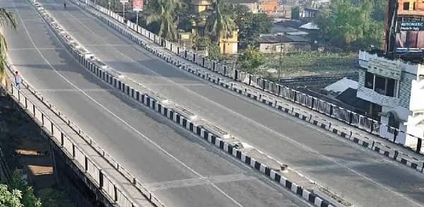
Chandmari Flyover Overview
| Detail | Information |
| Location | Chandmari, North Guwahati, Assam |
| Primary Road | Chandmari Road / AT Road Connector |
| Nearest Railway Station | Guwahati Railway Station — Approx. 2–3 km |
| Nearest Airport | Lokpriya Gopinath Bordoloi International Airport — Approx. 20–22 km |
| Key Roads Connected | Chandmari Road, AT Road, Narengi Road, Ganeshbari Road |
| Distance from Paltan Bazar | Approx. 3–4 km |
| Distance from Ganeshguri | Approx. 6–7 km |
| Distance from Narengi | Approx. 5–6 km |
| Governing Authority | NHAI, PWD Assam, GMC |
| Nearby Landmarks | Chandmari Market, Ganeshbari Temple, Narengi Cantonment |
| Structure Type | Elevated Road Overpass / Flyover |
| Public Transport Options | ASTC Bus, City Bus, App Cabs, Auto-Rickshaw |
| Best Suited For | North Guwahati inner city and Narengi corridor traffic |
| Peak Traffic Hours | 8:30 AM – 10:30 AM and 5:00 PM – 8:30 PM |
Directions to Chandmari Flyover
From Paltan Bazar / City Centre: Travel northward from Paltan Bazar via the connecting arterials heading toward the northern residential belt. Continue through the city’s inner northern road network toward Chandmari approximately 3 to 4 kilometres from the city center. Travel time is approximately 15 to 25 minutes through Guwahati’s characteristically congested inner city roads.
From Guwahati Railway Station: Exit the station and travel northward via the station approach roads heading toward Chandmari. The flyover is approximately 2 to 3 kilometres from the station — one of the closest major flyovers to Guwahati’s primary rail terminus — with a travel time of 10 to 20 minutes.
From Ganeshguri: Travel northwestward from Ganeshguri along the GS Road connector heading toward the Chandmari zone. The flyover is approximately 6 to 7 kilometres from Ganeshguri with a travel time of 20 to 30 minutes through the inner city road network.
From Narengi: Travel southward from Narengi along the Narengi Road heading toward Chandmari junction. The flyover is approximately 5 to 6 kilometres from Narengi’s residential zone with a travel time of 15 to 25 minutes — this route is heavily used by cantonment residents and Narengi families commuting toward Guwahati’s commercial core.
From Lokpriya Gopinath Bordoloi International Airport: Exit the airport and connect to the city approach road heading toward Paltan Bazar. Continue northward from the city center toward Chandmari. Total distance from the airport is approximately 20 to 22 kilometres with a travel time of 35 to 55 minutes.
Metro and Public Transport Connectivity
Guwahati’s metro project remains under development, meaning Chandmari currently depends on surface transport for public connectivity. City bus services operated by GMC and private operators run routes through the Chandmari corridor connecting the flyover area to Paltan Bazar, Guwahati Railway Station, Ganeshguri, and Narengi with reasonable frequency for an inner city zone of this population density. ASTC intercity buses connect Chandmari to Tezpur, Jorhat, and other Assam destinations via the Narengi Road corridor. Auto-rickshaws are extremely active throughout the Chandmari and Ganeshbari zone given the dense residential population’s short-trip connectivity needs. App-based cabs have grown substantially in this part of Guwahati given the growing professional population of the northern residential belt.
Road Connectivity
- Chandmari Road runs through the locality’s primary commercial and residential spine connecting the flyover to the broader inner city network.
- AT Road provides connectivity toward the Ambari and the city’s central institutional zone.
- Narengi Road extends northward toward the Narengi cantonment and the expanding northern residential townships.
- Ganeshbari Road connects westward into the Ganeshbari residential zone and the Kamakhya Temple approach roads.
Nearby Areas and Neighbourhoods
Narengi: A large residential and cantonment locality north of the flyover, Narengi houses both defence service personnel from the nearby cantonment and a growing civilian residential population attracted by the zone’s relative spaciousness compared to the inner city’s density.
Ganeshbari: A well-established residential locality west of Chandmari, Ganeshbari is known for its religious character — the locality sits within the broader Kamakhya Temple approach zone — and its stable middle-class residential community of government employees and professionals.
Chandmari Market: The local commercial market at the flyover junction is one of northern Guwahati’s most frequented retail destinations for daily needs, offering grocery, clothing, electronics, and the kind of neighborhood commercial variety that makes this locality functionally self-sufficient for its residential population.
Ambari: An important institutional and administrative locality south of Chandmari, Ambari houses several government offices and is directly connected to the flyover via AT Road, contributing institutional traffic to the junction’s daily movement.
Christian Basti: A well-established residential locality southeast of Chandmari, Christian Basti offers mid-segment housing and is directly connected to the flyover zone via the inner city road network serving this northern residential belt.
Frequently Asked Questions (FAQs)
Q1. Where is Chandmari Flyover located in Guwahati?
A: It is in Chandmari, North Guwahati, approximately 3 to 4 kilometres from Paltan Bazar city centre and 2 to 3 kilometres from Guwahati Railway Station.
Q2. How far is Chandmari from Guwahati Airport?
A: Lokpriya Gopinath Bordoloi International Airport is approximately 20 to 22 kilometres from Chandmari Flyover via the city approach road.
Q3. What residential areas are near Chandmari Flyover?
A: Narengi, Ganeshbari, and Christian Basti are the most prominent residential localities near the flyover.
Q4. What public transport options are available at Chandmari?
A: City buses, ASTC intercity services, auto-rickshaws, and app-based cabs serve the Chandmari junction throughout the day.
Q5. Is Chandmari Flyover near Guwahati Railway Station?
A: Yes, the flyover is approximately 2 to 3 kilometres from Guwahati Railway Station, making it one of the inner city’s most railway-proximate elevated structures.