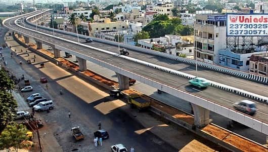
Central Hyderabad carries its historical weight differently from the glass-and-steel corridors of HITEC City — it is a zone where the old city’s cultural gravity still pulls strongly, where the residential fabric of decades-old colonies coexists with modern commercial establishments, and where the daily traffic of government offices, hospitals, colleges, and the dense residential communities of the central belt must navigate road infrastructure that was originally designed for a fraction of its current load. Narayanguda sits within this central Hyderabad character, at a junction that has served as a navigation reference point for the city’s residents for generations. The Narayanguda Flyover spans one of the central city’s more demanding crossings, providing the elevated relief that keeps the primary corridor traffic moving while the ground-level intersection manages the complex local movement of one of Hyderabad’s most densely populated central zones.
The locality’s name evokes a very Hyderabadi sense of place — a working middle-class neighborhood with strong community bonds, excellent food, reputed educational institutions, and the kind of lived-in urban character that newer residential zones are still decades away from developing. For the residents of Narayanguda, Himayatnagar, and the broader central Hyderabad residential belt, and for the enormous daily movement of students, government employees, and commercial operators through this junction, the flyover is the structure that makes the central city’s daily circulation manageable within a contemporary urban context.
Narayanguda Flyover Overview
| Detail | Information |
| Location | Narayanguda, Central Hyderabad, Telangana |
| Primary Road | Narayanguda Road / Himayatnagar Road |
| Nearest Metro Station | Narayanguda — Hyderabad Metro Red Line |
| Key Roads Connected | Narayanguda Road, Himayatnagar Road, Musheerabad Road, Nallakunta Road |
| Distance from Abids | Approx. 3–4 km |
| Distance from Secunderabad | Approx. 5–6 km |
| Distance from HITEC City | Approx. 20–22 km |
| Governing Authority | GHMC, HMDA, Telangana Roads and Buildings |
| Nearby Landmarks | Narayanguda Market, Himayatnagar Commercial Belt, Nallakunta Colony |
| Structure Type | Elevated Road Overpass / Flyover |
| Public Transport Options | Hyderabad Metro Red Line, TSRTC Bus, App Cabs, Auto-Rickshaw |
| Best Suited For | Central Hyderabad residential and commercial corridor traffic |
| Peak Traffic Hours | 9:00 AM – 11:00 AM and 5:30 PM – 9:00 PM |
Directions to Narayanguda Flyover
From Abids / City Centre: Travel northward from Abids along the primary city arterials heading toward the central residential belt. Continue through Himayatnagar and approach Narayanguda approximately 3 to 4 kilometres from Abids. Travel time is approximately 15 to 25 minutes through central Hyderabad’s characteristic mix of commercial and residential road traffic.
From Secunderabad Railway Station: Travel southward from Secunderabad along SD Road or the connecting arterials heading toward the central city. Continue through the Musheerabad corridor toward Narayanguda. Total distance is approximately 5 to 6 kilometres with a travel time of 20 to 30 minutes.
From HITEC City: Travel eastward from HITEC City through Ameerpet and continue eastward toward the Musheerabad and Narayanguda zone. Total distance is approximately 20 to 22 kilometres with a travel time of 40 to 60 minutes through Hyderabad’s cross-city traffic.
From Nallakunta: Travel southward from Nallakunta along Nallakunta Road heading toward Narayanguda junction. The flyover is approximately 2 to 3 kilometres from Nallakunta’s commercial center, accessible within 10 to 15 minutes.
From Charminar / Old City: Travel northward from Charminar via the old city arterials heading toward Abids. Continue northward through Abids toward Narayanguda approximately 6 to 7 kilometres from Charminar with a travel time of 20 to 35 minutes.
Metro and Public Transport Connectivity
Narayanguda Metro Station on the Hyderabad Metro Red Line is directly at the flyover junction, connecting this central Hyderabad node to the full Red Line corridor — westward through Ameerpet, HITEC City, and Miyapur, and eastward through Musheerabad, Secunderabad, and Nagole. The Red Line’s presence at Narayanguda has been transformative for this historically road-dependent central zone, providing rapid rail access to the IT employment corridor and the broad eastern suburban network from the heart of the old city’s northern residential belt. TSRTC buses operate multiple routes through the Narayanguda and Himayatnagar junction connecting the flyover area to Secunderabad Bus Stand, Mehdipatnam, Dilsukhnagar, and the broader city bus network. Auto-rickshaws serve the dense intra-neighborhood movement throughout the day.
Road Connectivity
- Narayanguda Road connects through the locality’s commercial spine linking the flyover to Himayatnagar and Abids.
- Himayatnagar Road extends southward toward the Himayatnagar commercial and residential belt.
- Musheerabad Road connects northward toward the Musheerabad zone and Secunderabad’s approach roads.
- Nallakunta Road extends northward into the Nallakunta residential and commercial locality.
Nearby Areas and Neighbourhoods
Himayatnagar: One of central Hyderabad’s most vibrant commercial and residential localities, Himayatnagar is known for its bookshops, coaching centers, cafes, and the young professional and student population that gives it an intellectually energetic street-level character.
Nallakunta: A densely populated residential locality north of the flyover, Nallakunta offers affordable middle-class housing with strong local market infrastructure and good public transport connectivity through the metro and bus networks.
Musheerabad: An important northern central Hyderabad junction connecting the flyover zone to the Secunderabad corridor, Musheerabad has a strong working-class residential and commercial character with busy local markets and the large daily traffic of government employees.
King Koti Area: The historically significant locality southwest of Narayanguda, home to the King Koti Hospital and the former palace of Hyderabad’s last Nizam, contributes institutional and heritage tourism traffic to the broader Narayanguda junction zone.
Barkatpura: An established residential and commercial locality adjacent to the flyover zone, Barkatpura offers mid-segment housing and commercial establishments that serve the central Hyderabad professional and government employee population.
Frequently Asked Questions (FAQs)
Q1. Where is Narayanguda Flyover located in Hyderabad?
A: It is in Narayanguda, Central Hyderabad, approximately 3 to 4 kilometres from Abids city centre, at the junction of Narayanguda Road and Himayatnagar Road.
Q2. Which metro station serves Narayanguda Flyover?
A: Narayanguda Metro Station on the Hyderabad Metro Red Line is directly at the flyover, connecting it to HITEC City and Nagole.
Q3. How far is Narayanguda from Secunderabad Railway Station?
A: Secunderabad Railway Station is approximately 5 to 6 kilometres from Narayanguda via the Musheerabad Road corridor.
Q4. What is the most popular commercial area near Narayanguda Flyover?
A: Himayatnagar’s commercial belt with its bookshops, cafes, and coaching centers is the most vibrant commercial destination near the flyover.
Q5. What residential areas are near Narayanguda Flyover?
A: Himayatnagar, Nallakunta, Musheerabad, and Barkatpura are the most prominent residential localities near the flyover.