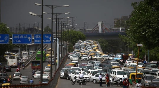
South Delhi has a particular talent for packaging enormous commercial and residential density within what appears from above to be a relatively ordered urban layout, and the stretch of Lala Lajpat Rai Marg between Lajpat Nagar and Defence Colony captures that quality perfectly. Moolchand sits at the junction of this arterial road with the Ring Road and the roads connecting toward Andrews Ganj, South Extension, and the institutional belt around AIIMS — a crossing that handles a remarkable daily volume of traffic from one of Delhi’s most affluent and commercially active residential corridors. The Moolchand Flyover has been managing this junction’s traffic demands for years, providing the elevated through-passage that keeps the Ring Road’s continuous flow intact while the ground-level signals handle the complex turning movements below.
The flyover takes its name from the Moolchand Hospital that anchors this junction’s identity as much as the road infrastructure does — a major private hospital that draws patients from across Delhi and the NCR and generates a steady stream of medical visitors, staff, and ambulances that add a distinctive layer to the junction’s already complex traffic composition. The surrounding area is one of South Delhi’s most densely packed with premium residential addresses, corporate offices, and upscale commercial establishments, giving the Moolchand corridor a very different character from Delhi’s more industrial northern and western flyover zones.
| Detail | Information |
| Location | Moolchand, South Delhi |
| Primary Road | Lala Lajpat Rai Marg / Ring Road |
| Nearest Metro Station | Moolchand — Delhi Metro Violet Line |
| Key Roads Connected | Lala Lajpat Rai Marg, Ring Road, Andrews Ganj Road, Defence Colony Road |
| Distance from Connaught Place | Approx. 7–9 km |
| Distance from AIIMS | Approx. 3–4 km |
| Distance from Lajpat Nagar | Approx. 2–3 km |
| Governing Authority | PWD Delhi, DMRC, South Delhi Municipal Corporation |
| Nearby Landmarks | Moolchand Hospital, Defence Colony Market, South Extension |
| Structure Type | Elevated Road Overpass / Flyover |
| Public Transport Options | Delhi Metro Violet Line, DTC Bus, App Cabs, Auto-Rickshaw |
| Best Suited For | South Delhi Ring Road and Lajpat Rai Marg corridor traffic |
| Peak Traffic Hours | 8:30 AM – 10:30 AM and 5:30 PM – 9:30 PM |
Directions to Moolchand Flyover
From Connaught Place: Travel southward from Connaught Place via Janpath or the Ring Road heading toward South Delhi. Continue along the Ring Road through INA and South Extension toward Moolchand. Total distance is approximately 7 to 9 kilometres with a travel time of 25 to 40 minutes through South Delhi’s premium residential corridor traffic.
From AIIMS: Travel southeastward from AIIMS along the Ring Road heading toward Lajpat Nagar. Moolchand Flyover is approximately 3 to 4 kilometres from AIIMS with a travel time of 10 to 20 minutes. This is a heavily used medical corridor for patients and staff moving between AIIMS and the Moolchand Hospital complex.
From Lajpat Nagar: Travel northwestward from Lajpat Nagar Central Market via Lala Lajpat Rai Marg heading toward the Ring Road junction. Moolchand Flyover is approximately 2 to 3 kilometres from the market, accessible within 10 to 15 minutes on this consistently active commercial road.
From Defence Colony: Travel westward from Defence Colony’s main market toward Lala Lajpat Rai Marg. Connect to the road heading north toward the Moolchand junction. Total distance from Defence Colony is approximately 1 to 2 kilometres, making this the shortest approach from any immediately adjacent locality.
From Noida via DND: Cross the DND into Delhi and travel westward via Mathura Road through Ashram Chowk. Continue along the Ring Road heading westward toward Moolchand. Total distance from central Noida is approximately 18 to 22 kilometres with a travel time of 35 to 55 minutes.
Metro and Public Transport Connectivity
Moolchand Metro Station on the Delhi Metro Violet Line sits directly at this junction, connecting the flyover area southward toward Lajpat Nagar — where interchange with the Pink Line provides access to the east-west South Delhi corridor — and northward toward Khan Market, JLN Stadium, and further to Kashmere Gate and the broader Delhi Metro network. The Violet Line’s coverage of this southeastern South Delhi belt provides the residential communities of Defence Colony, Lajpat Nagar, and Andrews Ganj with direct and reliable metro access that has become central to daily commuting in this part of the city. DTC buses operate along the Ring Road and Lala Lajpat Rai Marg serving multiple routes through the Moolchand corridor. App-based cabs are extremely well-supplied in this premium South Delhi zone throughout the day and evening.
Road Connectivity
- Lala Lajpat Rai Marg runs north to south through South Delhi’s primary residential and commercial corridor connecting Lajpat Nagar to the INA and South Extension zones.
- Ring Road provides circumferential connectivity linking Moolchand to AIIMS in the west and Ashram Chowk in the east.
- Andrews Ganj Road connects northwestward toward the Andrews Ganj residential zone and the Siri Fort area.
- Defence Colony Road extends eastward into one of South Delhi’s most prestigious planned residential colonies.
Nearby Areas and Neighbourhoods
Defence Colony: One of Delhi’s most prestigious and well-maintained residential colonies, Defence Colony offers premium independent houses, a vibrant market street famous for restaurants and boutique shops, and a strong community character that has made it one of South Delhi’s most sought-after addresses for decades.
Lajpat Nagar: South Delhi’s most commercially active market hub is directly accessible from Moolchand via the metro or a short road stretch, drawing shoppers from across Delhi for its textile markets, jewelry shops, and the diverse street food that has made Lajpat Nagar’s food culture genuinely celebrated.
South Extension: One of Delhi’s most premium retail destinations, South Extension Parts 1 and 2 are located within easy reach of the Moolchand corridor and offer flagship retail stores, restaurants, and the kind of upscale commercial environment that serves South Delhi’s affluent residential population.
Andrews Ganj: A quieter upscale residential zone adjacent to the flyover, Andrews Ganj offers premium housing within the institutional belt that includes Siri Fort Auditorium and the Asia Games Village complex.
Moolchand Hospital Zone: The medical complex anchoring the junction draws patients and families from across Delhi and the NCR, making healthcare access one of the notable functional purposes that the flyover serves beyond its pure traffic management role.
Frequently Asked Questions (FAQs)
Q1. Where is Moolchand Flyover located in Delhi?
It is in Moolchand, South Delhi, at the junction of Lala Lajpat Rai Marg and Ring Road, approximately 7 to 9 kilometres from Connaught Place.
Q2. Which metro station serves Moolchand Flyover?
Moolchand Metro Station on the Delhi Metro Violet Line is directly at the flyover, with interchange access at Lajpat Nagar with the Pink Line.
Q3. How far is Moolchand from AIIMS?
AIIMS is approximately 3 to 4 kilometres from Moolchand Flyover via the Ring Road.
Q4. What are the key residential areas near Moolchand Flyover?
Defence Colony, Lajpat Nagar, Andrews Ganj, and South Extension are the most prominent residential and commercial localities near the flyover.
Q5. Is Moolchand Hospital near the flyover?
Yes, Moolchand Hospital is the landmark that gives the junction its name and is located directly at the flyover junction.