Eastern Mumbai has a momentum of its own that is different from the western suburbs’ commercial buzz or South Mumbai’s institutional gravitas. The eastern corridor stretching from Chembur through Ghatkopar and Mankhurd toward the Thane Creek carries an industrial and working-class residential energy that has sustained Mumbai’s economic engine for generations. Mankhurd sits at an important junction point within this eastern corridor, at the boundary zone between Ghatkopar’s increasingly commercial character and the transitional urban-semi-industrial fabric that lies between the city proper and Navi Mumbai across the creek. The Mankhurd Flyover spans one of this eastern corridor’s more demanding junctions, managing the complex traffic convergence of Eastern Express Highway vehicles, suburban railway commuters, Navi Mumbai-bound travelers, and the dense residential commuter population of eastern Mumbai’s working-class neighborhoods.
The flyover’s position near the Mankhurd railway station and its connection to the Sion-Panvel Highway make it a genuinely multimodal structure — it serves road travelers transitioning between Mumbai’s inner eastern zone and the outer suburban and Navi Mumbai corridors while sitting within the catchment of both the Central Railway suburban network and the Harbour Line’s eastern extension. For the enormous working-class population of Mankhurd, Govandi, Cheetah Camp, and the transitional residential zones along the Sion-Panvel Highway, this flyover is daily infrastructure whose reliability directly affects the morning commute of communities that cannot easily absorb delays.
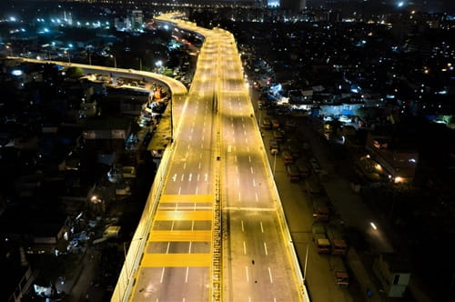
Mankhurd Flyover Overview
| Detail | Information |
| Location | Mankhurd, Ghatkopar, East Mumbai, Maharashtra |
| Primary Road | Eastern Express Highway / Sion-Panvel Highway |
| Nearest Metro Station | Mankhurd — Mumbai Metro Line 2B |
| Nearest Railway Station | Mankhurd Railway Station — Approx. 1 km |
| Key Roads Connected | Eastern Express Highway, Sion-Panvel Highway, Govandi Road, Cheetah Camp Road |
| Distance from CST | Approx. 20–22 km |
| Distance from Thane | Approx. 15–18 km via Eastern Express Highway |
| Distance from Vashi (Navi Mumbai) | Approx. 8–10 km via Sion-Panvel Highway |
| Governing Authority | BMC, MSRDC, MMRDA |
| Nearby Landmarks | Mankhurd Railway Station, Govandi, Cheetah Camp |
| Structure Type | Elevated Road Overpass / Flyover |
| Public Transport Options | Mumbai Metro Line 2B, Central Railway, BEST Bus, App Cabs |
| Best Suited For | East Mumbai Eastern Freeway and Navi Mumbai approach corridor |
| Peak Traffic Hours | 7:30 AM – 10:30 AM and 6:00 PM – 9:30 PM |
Directions to Mankhurd Flyover
From CST / South Mumbai: Travel northward along the Eastern Express Highway from the southern city. Continue past Chembur and Ghatkopar approaching the Mankhurd zone approximately 20 to 22 kilometres from CST. Travel time is approximately 35 to 55 minutes depending on Eastern Express Highway conditions through the eastern suburban corridor.
From Ghatkopar: Travel southward from Ghatkopar along the Eastern Express Highway or the service roads heading toward Mankhurd. The flyover is approximately 4 to 5 kilometres from Ghatkopar Metro Station with a travel time of 10 to 20 minutes through the eastern corridor.
From Thane: Travel southwestward along the Eastern Express Highway from Thane heading toward Mumbai. Continue past Bhandup and Mulund approaching Mankhurd approximately 15 to 18 kilometres from Thane with a travel time of 25 to 40 minutes.
From Vashi / Navi Mumbai: Cross the Thane Creek via the Vashi Bridge heading westward along the Sion-Panvel Highway toward Mumbai. Mankhurd Flyover is approximately 8 to 10 kilometres from Vashi with a travel time of 20 to 30 minutes — the most direct Navi Mumbai approach to the flyover zone.
From Chembur: Travel eastward from Chembur via the Amar Mahal and Mankhurd Road heading toward the Eastern Express Highway junction. The flyover is approximately 5 to 7 kilometres from the Chembur commercial center with a travel time of 15 to 25 minutes.
Metro and Public Transport Connectivity
Mankhurd Metro Station on Mumbai Metro Line 2B brings rail connectivity to this eastern suburban junction, connecting the Mankhurd zone westward through Chembur, Dharavi, BKC, and Bandra — providing eastern Mumbai’s working-class residential population with direct metro access to one of the city’s most commercially valuable districts without the lengthy commute that road travel demands. Mankhurd Railway Station on the Central Railway’s Harbour Line is located approximately 1 kilometre from the flyover, providing suburban rail connectivity northward toward Kurla and southward toward Vashi and Panvel. BEST buses serve multiple routes through the Mankhurd corridor, and app-based cabs are available throughout the day for the varied transport needs of this multimodal junction zone.
Road Connectivity
- Eastern Express Highway runs north to south connecting Mankhurd to Ghatkopar, Bhandup, Thane, and southward toward CST and South Mumbai.
- Sion-Panvel Highway (NH-4B) extends eastward across the Thane Creek toward Navi Mumbai, Panvel, and the broader Konkan and Mumbai-Pune highway network.
- Govandi Road connects northward toward the Govandi residential zone.
- Cheetah Camp Road provides access into the Cheetah Camp locality’s residential interior.
Nearby Areas and Neighbourhoods
Govandi: A densely populated eastern suburban locality immediately north of the flyover, Govandi is one of Mumbai’s most working-class residential zones, housing a large population of industrial workers, domestic workers, and daily wage laborers whose daily commutes depend heavily on the Eastern Express Highway corridor.
Cheetah Camp: A large residential locality adjacent to the flyover zone, Cheetah Camp has a significant community character shaped by its position between Mumbai’s formal urban boundary and the transitional zone toward Navi Mumbai’s creek crossing.
Trombay: The industrial and research township of Trombay, home to the Bhabha Atomic Research Center, is accessible from the Mankhurd corridor and adds an institutional dimension to the zone’s economic character.
Vashi and Navi Mumbai: The planned city of Navi Mumbai begins across the Thane Creek from the Mankhurd zone, and the Sion-Panvel Highway connection makes Mankhurd Flyover the primary road gateway for eastern Mumbai residents commuting toward Navi Mumbai’s IT and commercial zones.
Kurla: A major commercial and residential hub in Eastern Mumbai connected to Mankhurd via the Eastern Express Highway and Harbour Line, Kurla’s large market area and Kurla Terminus serve as important commercial destinations for the Mankhurd residential population.
Frequently Asked Questions (FAQs)
Q1. Where is Mankhurd Flyover located in Mumbai?
A: It is in Mankhurd, Ghatkopar, East Mumbai, at the junction of the Eastern Express Highway and Sion-Panvel Highway, approximately 20 to 22 kilometres from CST.
Q2. Which metro station serves Mankhurd Flyover?
A: Mankhurd Metro Station on Mumbai Metro Line 2B provides direct connectivity to BKC and Bandra from this eastern junction.
Q3. How far is Mankhurd from Vashi in Navi Mumbai?
A: Vashi is approximately 8 to 10 kilometres from Mankhurd via the Sion-Panvel Highway across the Thane Creek.
Q4. Which railway station is nearest to Mankhurd Flyover?
A: Mankhurd Railway Station on the Harbour Line is approximately 1 kilometre from the flyover, making it one of the most railway-proximate flyovers in east Mumbai.
Q5. What residential areas are near Mankhurd Flyover?
A: Govandi, Cheetah Camp, and the broader eastern suburban residential belt are the most prominent localities near the flyover.