 By Ketan Kumar
 Vijayawada moves with the urgency of a city that knows its importance. Sitting at the geographic heart of Andhra Pradesh, flanked by the Krishna River and anchored by one of South India’s most important railway junctions, it has always been a city of transit — goods, people, and commerce flowing through it in volumes that give its road infrastructure a significance beyond the merely municipal. Singh Nagar sits within this busy urban fabric, at a junction in the western residential and commercial belt where the roads connecting the older city core to the expanding western localities must manage a traffic convergence that reflects Vijayawada’s relentless forward momentum. The Singh Nagar Flyover spans this junction, providing the elevated through-passage that keeps the western corridor’s primary road movement flowing while the ground-level intersection handles the demanding local and cross-traffic below.
The surrounding area has developed into one of Vijayawada’s more commercially active western zones, with residential colonies, trading establishments, educational institutions, and the kind of dense neighborhood commercial activity that characterises the mid-city residential belt of a major Andhra Pradesh urban center. For the large residential population of Singh Nagar, Payakapuram, Bhavanipuram, and the broader western residential corridors, this flyover is the daily transit structure that makes the morning commute toward the railway station, the commercial zones of Governorpet and Labbipet, and the connectivity toward the National Highway network manageable rather than exhausting.
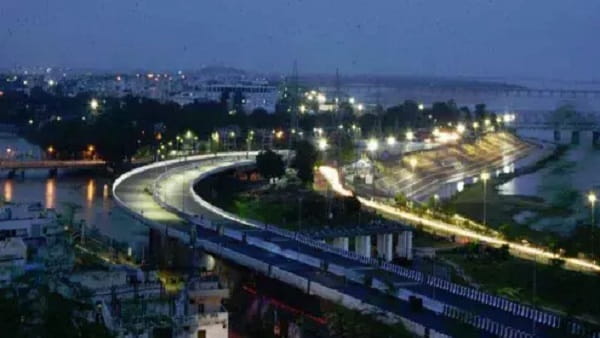
Singh Nagar Flyover Overview
| Detail | Information |
| Location | Singh Nagar, West Vijayawada, Andhra Pradesh |
| Primary Road | Singh Nagar Road / Eluru Road Connector |
| Nearest Railway Station | Vijayawada Railway Station — Approx. 5–7 km |
| Nearest Airport | Vijayawada International Airport — Approx. 20–22 km |
| Key Roads Connected | Singh Nagar Road, Eluru Road, Payakapuram Road, Bhavanipuram Road |
| Distance from City Centre (Governorpet) | Approx. 4–5 km |
| Distance from Eluru Road | Approx. 2–3 km |
| Distance from Vijayawada Railway Station | Approx. 5–7 km |
| Governing Authority | NHAI, VMC, Andhra Pradesh Roads and Buildings |
| Nearby Landmarks | Singh Nagar Market, Payakapuram Colony, Bhavanipuram Housing Board |
| Structure Type | Elevated Road Overpass / Flyover |
| Public Transport Options | APSRTC Bus, City Bus, App Cabs, Auto-Rickshaw |
| Best Suited For | West Vijayawada residential corridor and Eluru Road traffic |
| Peak Traffic Hours | 8:30 AM – 10:30 AM and 5:00 PM – 8:30 PM |
Directions to Singh Nagar Flyover
From Vijayawada Railway Station: Exit the station and travel westward via Eluru Road heading toward the western residential belt. Continue through Governorpet and Labbipet toward the Singh Nagar zone approximately 5 to 7 kilometres from the station. Travel time is approximately 20 to 35 minutes through Vijayawada’s characteristically dense commercial and residential arterials.
From Governorpet / City Centre: Travel westward from Governorpet along Eluru Road heading toward the Singh Nagar corridor. The flyover is approximately 4 to 5 kilometres from the central commercial zone with a travel time of 15 to 25 minutes through the western city road network.
From Payakapuram: Travel northward or eastward from Payakapuram Colony via the Payakapuram Road connecting to Singh Nagar junction. The flyover is approximately 2 to 3 kilometres from Payakapuram’s residential core, accessible within 10 to 15 minutes.
From Bhavanipuram: Travel northward from Bhavanipuram’s Housing Board colony via the connecting roads heading toward Singh Nagar junction. The flyover is approximately 3 to 4 kilometres from Bhavanipuram with a travel time of 10 to 20 minutes through the western residential road network.
From Eluru via NH-16: Travel eastward from Eluru along NH-16 heading toward Vijayawada. Enter the city via Eluru Road and continue toward Singh Nagar junction approximately 60 kilometres from Eluru with a travel time of 70 to 90 minutes from Eluru city center.
Metro and Public Transport Connectivity
Vijayawada does not currently have an operational metro system, though the city’s metropolitan planning includes rapid transit infrastructure as a future priority for Andhra Pradesh’s capital region corridor. APSRTC operates comprehensive bus services through the Singh Nagar and Eluru Road corridor connecting the flyover area to Vijayawada Bus Station, the railway station, Bhavanipuram, Payakapuram, and destinations along the Eluru highway. City bus services run multiple routes through this western corridor with reasonable frequency given the large residential population of the western belt. Auto-rickshaws operate abundantly throughout Singh Nagar and the surrounding localities providing the primary intra-neighborhood connectivity. App-based cabs have seen growing adoption among Vijayawada’s professional residential population, particularly for journeys toward the airport and railway station.
Road Connectivity
- Eluru Road runs east to west as Vijayawada’s primary western arterial connecting the city center to the Eluru highway corridor and beyond.
- Singh Nagar Road provides the primary commercial and residential spine connectivity within the immediate flyover zone.
- Payakapuram Road extends southward toward the established Payakapuram residential colony.
- Bhavanipuram Road connects southwestward toward the Bhavanipuram Housing Board colony and its surrounding communities.
Nearby Areas and Neighbourhoods
Payakapuram: One of Vijayawada’s most established western residential localities, Payakapuram offers well-developed colony housing for government employees and working professionals with strong local market infrastructure and good connectivity toward the city center via Eluru Road.
Bhavanipuram: A large planned residential locality housing board colonies south of the flyover, Bhavanipuram provides affordable housing for Vijayawada’s working-class and government employee population within a structured residential environment.
Labbipet: One of Vijayawada’s most commercially vibrant residential localities, Labbipet sits between the flyover zone and the city center along Eluru Road and offers the kind of dense neighborhood commercial activity that makes this stretch of western Vijayawada genuinely self-sufficient.
Siddhartha Nagar: An established residential locality within the western belt connected to the Singh Nagar corridor, Siddhartha Nagar offers mid-segment housing with strong educational institution proximity making it popular among families prioritizing schooling options.
Auto Nagar Industrial Area: Vijayawada’s significant automobile and engineering industrial zone is accessible from the Singh Nagar corridor and contributes commercial vehicle traffic to the flyover’s daily movement patterns.
Frequently Asked Questions (FAQs)
Q1. Where is Singh Nagar Flyover located in Vijayawada?
A: It is in Singh Nagar, West Vijayawada, on the Singh Nagar Road and Eluru Road connector, approximately 4 to 5 kilometres from Governorpet city centre.
Q2. How far is Singh Nagar Flyover from Vijayawada Railway Station?
A: The railway station is approximately 5 to 7 kilometres from the flyover via Eluru Road, with a travel time of 20 to 35 minutes.
Q3. Is there metro connectivity at Singh Nagar Flyover?
A: Vijayawada does not currently have an operational metro. APSRTC buses and auto-rickshaws provide the primary public transport coverage.
Q4. What residential colonies are near Singh Nagar Flyover?
A: Payakapuram, Bhavanipuram, and Siddhartha Nagar are the most prominent residential localities near the flyover.
Q5. How far is Singh Nagar from Vijayawada Airport?
A: Vijayawada International Airport is approximately 20 to 22 kilometres from the flyover, with a travel time of 35 to 50 minutes.