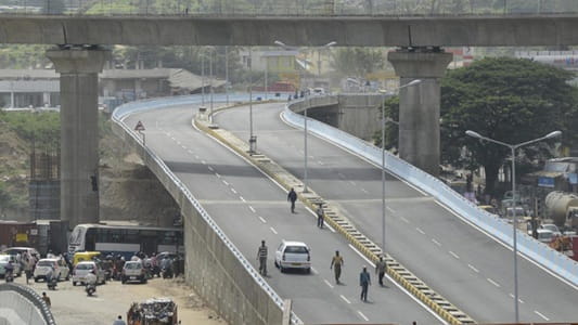
Mysore Road has always been more than just a road out of Bengaluru toward Karnataka’s cultural capital — it is a corridor that carries the daily weight of an enormous western suburban population, the industrial traffic of Peenya and the Ring Road manufacturing belt, and the leisure and pilgrimage movement of Bengaluru’s residents heading toward Mysuru, Coorg, and the heritage destinations of southern Karnataka. Nayandahalli sits at a critical point along this corridor, at the junction where Mysore Road transitions from the city’s inner western suburban fabric to the more open stretch heading toward Kengeri and the urban boundary. The Nayandahalli Flyover spans this junction with the elevated efficiency that a road carrying this volume and diversity of traffic demands.
The flyover’s position on the Namma Metro Purple Line’s operational corridor adds a public transport dimension that gives Nayandahalli a multimodal significance beyond simple road infrastructure. The combination of the Purple Line metro, the Mysore Road satellite bus station, and the flyover creates an intermodal transit node of genuine functional value for western Bengaluru’s large commuter population. For residents of Rajarajeshwari Nagar, Kengeri, Uttarahalli, and the expanding western townships who commute daily toward the city center and beyond, Nayandahalli is not just a flyover — it is the point where multiple transport systems come together to make the western corridor work.
| Detail | Information |
| Location | Nayandahalli, West Bengaluru, Karnataka |
| Primary Road | Mysore Road (NH-275) |
| Nearest Metro Station | Nayandahalli — Namma Metro Purple Line |
| Key Roads Connected | Mysore Road (NH-275), Outer Ring Road connector, Rajarajeshwari Nagar Road, Uttarahalli Road |
| Distance from Majestic / City Centre | Approx. 8–10 km |
| Distance from Kengeri | Approx. 5–6 km |
| Distance from Mysuru | Approx. 138 km via NH-275 |
| Governing Authority | BBMP, NHAI, BDA |
| Nearby Landmarks | Mysore Road Satellite Bus Station, Rajarajeshwari Nagar, Nayandahalli Lake |
| Structure Type | Elevated Road Overpass / Flyover |
| Public Transport Options | Namma Metro Purple Line, KSRTC Bus, BMTC Bus, App Cabs |
| Best Suited For | West Bengaluru Mysore Road and Kengeri corridor traffic |
| Peak Traffic Hours | 8:00 AM – 10:30 AM and 5:30 PM – 9:00 PM |
Directions to Nayandahalli Flyover
From Majestic / City Centre: Travel westward from Majestic along Mysore Road heading toward the western suburban belt. Continue through Deepanjali Nagar and Attiguppe toward Nayandahalli. The flyover is approximately 8 to 10 kilometres from Majestic with a travel time of 25 to 40 minutes through the consistently busy Mysore Road corridor.
From Kengeri: Travel eastward from Kengeri along Mysore Road heading toward the city center. Nayandahalli Flyover is approximately 5 to 6 kilometres from Kengeri’s main junction with a travel time of 15 to 25 minutes — the most direct eastward approach from the western suburban terminus.
From Outer Ring Road: Exit the ORR at the Mysore Road junction heading eastward. Nayandahalli is accessible within 3 to 4 kilometres of the ORR-Mysore Road junction, making this the preferred approach for vehicles entering the corridor from the ring road network heading toward the city center.
From Mysuru via NH-275: Travel northeastward along NH-275 from Mysuru heading toward Bengaluru. Continue through Bidadi and Ramanagara and approach the city via Mysore Road. Nayandahalli Flyover is encountered approximately 138 kilometres from Mysuru as Mysore Road enters Bengaluru’s urban boundary from the southwestern direction.
From Rajarajeshwari Nagar: Travel eastward from Rajarajeshwari Nagar’s residential zones via the connecting roads heading toward Mysore Road. Nayandahalli is approximately 4 to 5 kilometres from the center of Rajarajeshwari Nagar with a travel time of 15 to 20 minutes through the residential connector roads.
Metro and Public Transport Connectivity
Nayandahalli Metro Station on the Namma Metro Purple Line sits directly adjacent to the flyover, connecting this western junction to the full Purple Line corridor — eastward through Attiguppe, Vijayanagar, Magadi Road, City Railway Station, Chickpete, Majestic, and all the way to Whitefield and Baiyappanahalli. The Purple Line’s presence at Nayandahalli has been genuinely transformative for western Bengaluru’s commuter population, providing a fast and reliable metro alternative to Mysore Road’s often congested surface traffic. The Mysore Road Satellite Bus Station, located within the Nayandahalli zone, serves as the departure point for KSRTC services to Mysuru, Mandya, Hassan, and Mangaluru — giving this junction a long-distance bus connectivity that complements the metro’s urban coverage. BMTC city buses operate multiple routes along Mysore Road connecting Nayandahalli to Majestic, Kengeri, and the western residential belt.
Road Connectivity
- Mysore Road (NH-275) runs east to west as Bengaluru’s primary western highway connecting the city to Kengeri, Ramanagara, and Mysuru.
- Outer Ring Road connects northward and southward along Bengaluru’s western circumferential road linking Nayandahalli to Peenya, Tumkur Road, and Bannerghatta Road.
- Rajarajeshwari Nagar Road extends northwestward into one of west Bengaluru’s largest planned residential zones.
- Uttarahalli Road connects southward into the Uttarahalli residential and commercial locality.
Nearby Areas and Neighbourhoods
Rajarajeshwari Nagar: One of western Bengaluru’s largest and most self-contained planned residential localities, Rajarajeshwari Nagar has grown into a thriving community with reputed schools, hospitals, local markets, and a strong middle-class residential character that makes it one of the more popular addresses for families seeking affordable western Bengaluru living.
Kengeri: The western suburban terminus of the Namma Metro Purple Line, Kengeri has developed into a significant commercial and residential hub in its own right, offering the kind of township-scale development and civic infrastructure that draws residents seeking Bengaluru addresses without Bengaluru prices.
Mysore Road Satellite Bus Station: Located adjacent to the Nayandahalli junction, this satellite terminal allows west Bengaluru residents to board KSRTC long-distance buses for Mysuru, Mandya, Hassan, and Coorg without the journey to KBS Majestic — a practical convenience that the large western residential population values considerably.
Uttarahalli: An established residential locality south of Nayandahalli along the ORR corridor, Uttarahalli offers affordable independent houses and apartment developments with reasonable connectivity to both Mysore Road and Bannerghatta Road.
Nayandahalli Lake: The urban lake within the Nayandahalli zone provides a natural ecological asset within this transitional urban-suburban landscape, and community efforts to maintain its quality have been sustained despite the considerable development pressure the area has experienced.
Frequently Asked Questions (FAQs)
Q1. Where is Nayandahalli Flyover located in Bengaluru?
It is in Nayandahalli, West Bengaluru, on Mysore Road (NH-275), approximately 8 to 10 kilometres from Majestic city centre.
Q2. Which metro station serves Nayandahalli Flyover?
Nayandahalli Metro Station on the Namma Metro Purple Line is directly adjacent to the flyover, connecting it to Whitefield in the east and Kengeri in the west.
Q3. Is there a bus station near Nayandahalli Flyover?
Yes, the Mysore Road Satellite Bus Station is located adjacent to the Nayandahalli junction, offering KSRTC services to Mysuru, Mandya, Hassan, and other South Karnataka destinations.
Q4. How far is Nayandahalli from Kengeri?
Kengeri is approximately 5 to 6 kilometres west of Nayandahalli along Mysore Road, accessible within 15 to 25 minutes.
Q5. What residential areas are near Nayandahalli Flyover?
Rajarajeshwari Nagar, Kengeri, Uttarahalli, and the broader western Bengaluru suburban belt are the most prominent residential localities near the flyover.